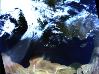
In the framework of I-AMICA project, a system for publishing satellite data has been developed. The aim of this action is the implementation of a web service of classified MODIS data visualization. The data are daily acquired and they are processed and ready for the web after 4 days. The area covered by this service is the Mediterranean basin and 4 to 6 images are necessary every day to cover the area. The data are processed for atmospheric dust detection and 5 classes are extracted from thermal data. The data have a spatial resolution of 1 km.
The maps are available at http://sharegeonetwork.i-amica.it/modis/